
That's La Plagne contains affiliate links and is a member of the Amazon affiliate program. If you make a purchase using one of these links, I may receive a small commission - at no extra cost to you. I never recommend anything I haven't experienced myself, and the commission helps me keep this site running at full speed! See my Disclosure Policy for extra information.
All the La Plagne Maps you need
About La Plagne – everything you need to know
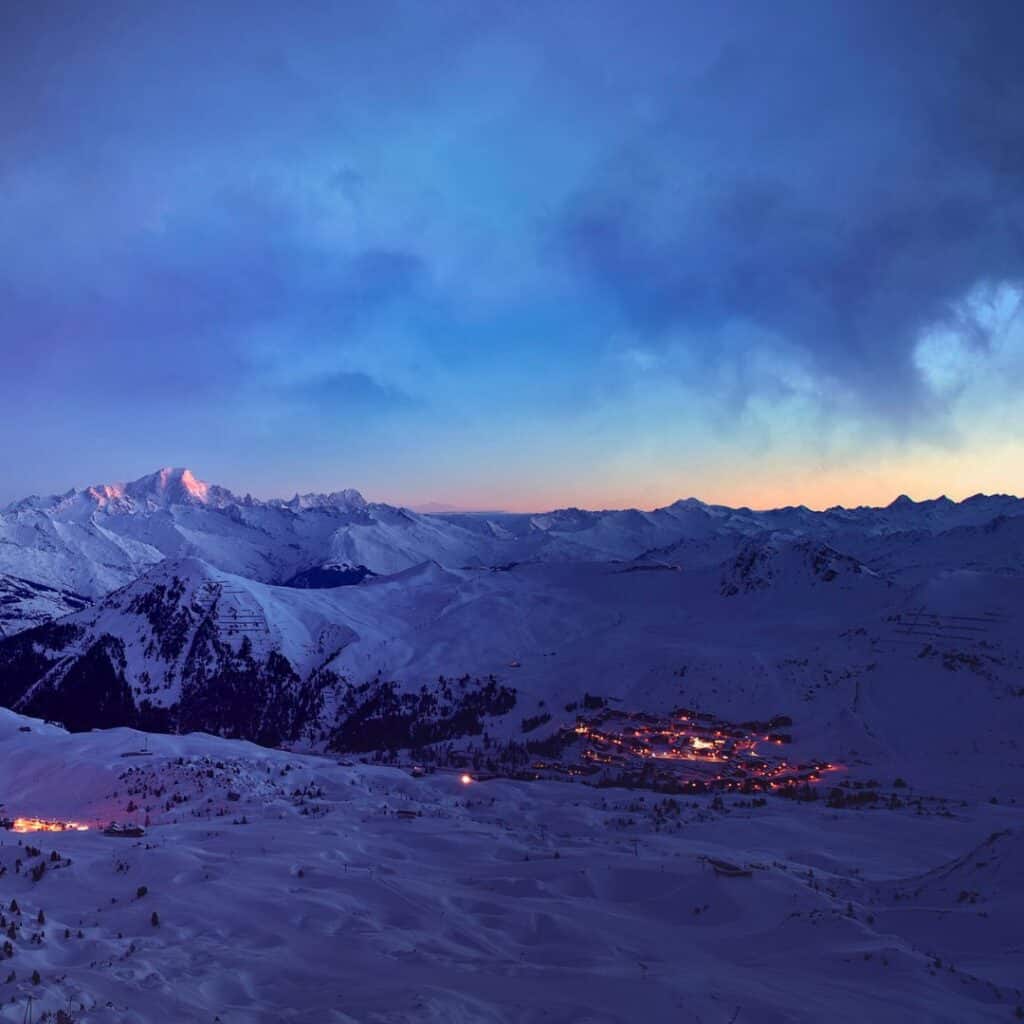
La Plagne lies in the Tarentaise Valley in the French Alps. It's a captivating French ski resort renowned for its winter allure.
In 2003, an exciting amalgamation occurred, uniting La Plagne with the neighbouring Les Arcs ski resort, thus birthing the astounding Paradiski ski area. This alpine masterpiece seamlessly merges the two resorts, forging an epic winter playground that leaves avid skiers and snowboarders utterly mesmerized.
Central to this unparalleled experience is the awe-inspiring Vanoise Express, an engineering marvel and the world's grandest cable car. With two cabins that gracefully alternate, this colossal transport system effortlessly carries up to 201 thrill-seekers across the sprawling valley, fostering an unmatched sense of adventure and connection.
Debates may often ensue regarding the title of the planet's grandest ski resort, fueled by the varying metrics of piste count, skiable kilometres, and overall acreage. Yet, amidst this spirited contest, the Paradiski ski area shines as one of Europe's grandest winter playgrounds, embracing a breathtaking expanse of 425 kilometres of skiable pistes, a true testimony to the region's commitment to snow sports. Not to be outdone, the resort boasts an impressive fleet of 160 lifts, effortlessly whisking skiers and snowboarders to newfound heights of delight.
Get all the juiciest inside secrets about La Plagne, direct to your inbox.
La Plagne lift pass sales, accommodation deals & ski school discounts before anyone else knows about them.
La Plagne vs Paradiski Ski Regions
La Plagne is actually a collection of 10 smaller villages. The altitude villages:
- La Roche, Plagne Centre, Aime 2000, Plagne 1800, Plagne Villages, Plagne Soleil, Bellecôte and Belle Plagne
and then the valley villages:
- Montchavin/Les Coches and Mont Albert.
Then as I say above, the Paradiski area is the combination of the whole La Plagne area and the Les Arcs area. In winter, the 2 resorts are connected by the Vanoise Express. In the summer, you need to use the roads to get from one resort to another.
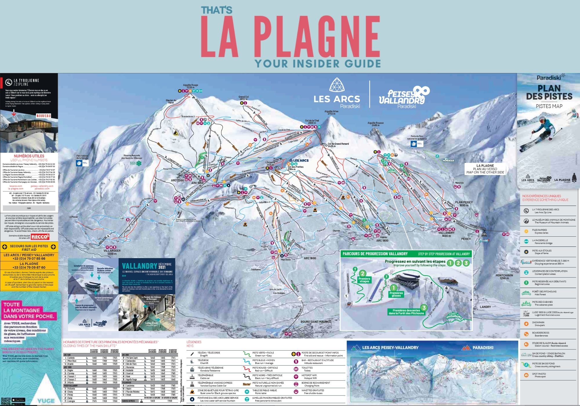
La Plagne Piste Map
- Open the digital copy of the La Plagne piste map by clicking on the photo
- Download a copy of the La Plagne piste map.
- Use the interactive La Plagne piste map.

Paridiski Piste Map
- Open the digital copy of the Paradiski piste map by clicking on the photo
- Download a copy of the Paradiski Piste map.
- Use the interactive Paradiski Piste Map.
FOLLOW MY WEEKLY LA PLAGNE SNOW REPORTS
Read real time snow reports or watch my video reports to see what the snow actually looks like 🤩
La Plagne Walking and hiking maps
There is a vast network of walking trails throughout La Plagne. It's a great way to explore the resort without your skis. Both in winter and in summer.
Always check on the day that the walking trails are open, especially after heavy snow or rain. And if you want to learn about the La Plagne 6000D trail running event every summer, check out my review for everything you need to know.
La Plagne Cross Country Trail Maps
If you fancy trying some cross-country skiing, head to the designated trails and routes to enjoy the La Plagne winter ski resort. In fact, there's a whole blog post dedicated to Cross Country & Nordic skiing here.
La Plagne Village Maps
Here you can find all the La Plagne village maps for each of the different La Plagne villages. You can use the digital PDF or download it and save it for when you need it.
La Plagne Parking Maps
There is some free parking along the roads throughout the different La Plagne villages, BUT it is limited. Check with your accommodation provider to see if there is parking included in the booking or if they have a space available that you can pay for – usually the best and most reasonable option.
There are several paid public car parks, several underground options and a dedicated motorhome parking. In the winter they are approx. 72€ per car, per week. And in summer, they are free. You can read all about La Plagne parking options here to get the best solution for you.
Check out the La Plagne Parking map to see what's available for you.
Summer Bike Trail Maps
La Plagne has multiple options for your biking fun. Look at the marked mountain bike trails “Bike Park”. Or explore the winder area with Ebike routes.
Of course, road biking is an option too…just use the roads!
There are routes and trails available for all ages and abilities, and it's an amazing way to explore the mountains.
Honestly, I've skied La Plagne for over a decade and was blown away by how different the mountains were flying down them on a bike.
You can find out all about the La Plagne bike park and then more information on how to get into mountain biking in La Plagne.
That's La Plagne and all the La Plagne Maps you need!
What else do you want to know?
You can find links below to all my different information pages. BUT if there is something specific you want to know, then leave me a comment below 👇 I'll do my best to find the answer for you.
GET YOUR LA PLAGNE RESTAURANT GUIDE HERE
Instead of searching dozens of articles, get your complete Restaurant Guide with:
- Takeaway options
- 70+ restaurants
- Family recommendations
- Resort-by-resort listings
- Local favourites
- Mountain restaurants

One Comment